Report #14: Kyrgyz Tribal Map
On weekends I was visiting my hometown of Osh. Caught up with some of my childhood friends on Ibraimova 28, whom I had not seen in at least 8 years. Also, visited relatives in Osh/Nookat/Ozgon for iftars (evening meals on Ramadan to break the fast). Great weekend.
Plus, I visited the Great Silk Road Museum at the foothill of the Mount Suleiman in Osh. There, I saw the only existing comprehensive Pre-1917 Tribal Map (although Soviet-made) of the Kyrgyz people. I took some pictures of the map in sections and now I am presenting them to you (appologize for low quality). I am sure the map can help you to make some interesting discoveries. Please note that this map does not reflect the internal migration during the Soviet Union and last 15 years when it increased significantly, of which I am a part.
When you have a chance to visit Osh, please visit the museum to see the map and many other interesting things displayed there.
p.s. I tried to post maps of higher resolutions, but for some reason Blogger automatically shrank them. For more detailed maps, leave a message in the comments.
Legend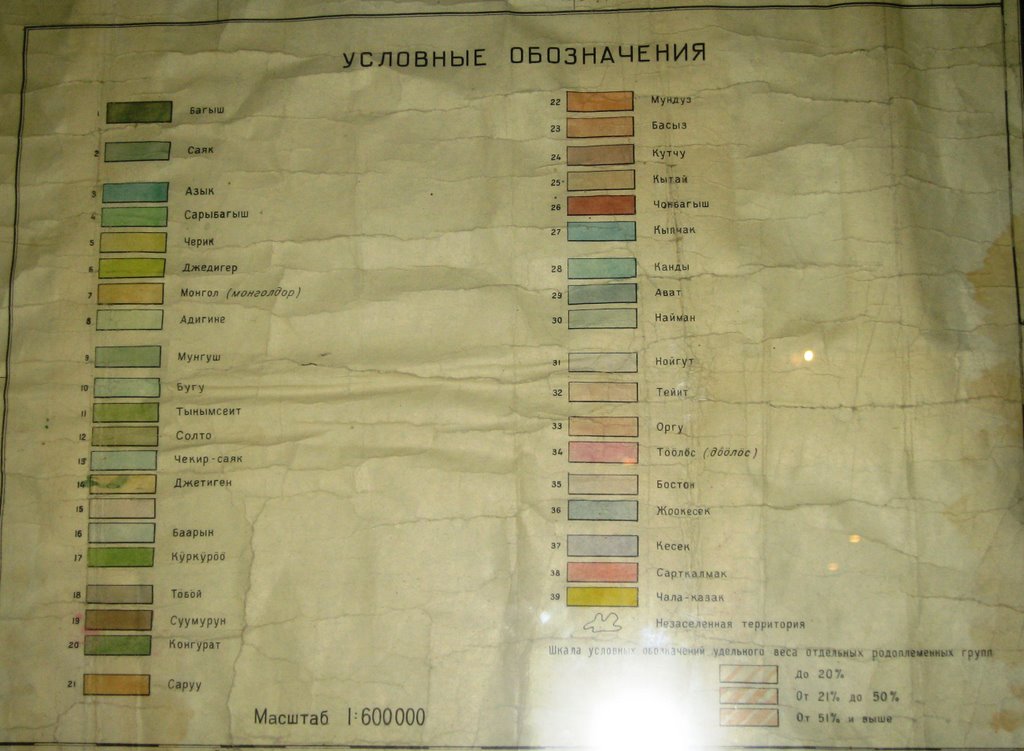 Talas and Jalalabad
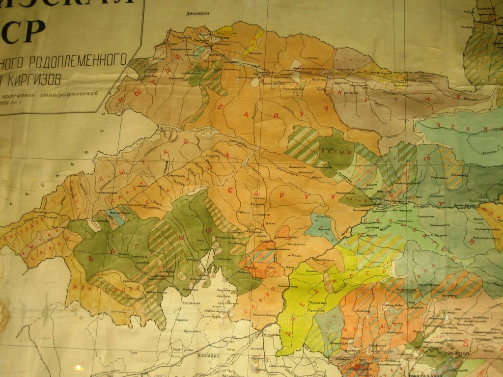 Chui and Suusamyr
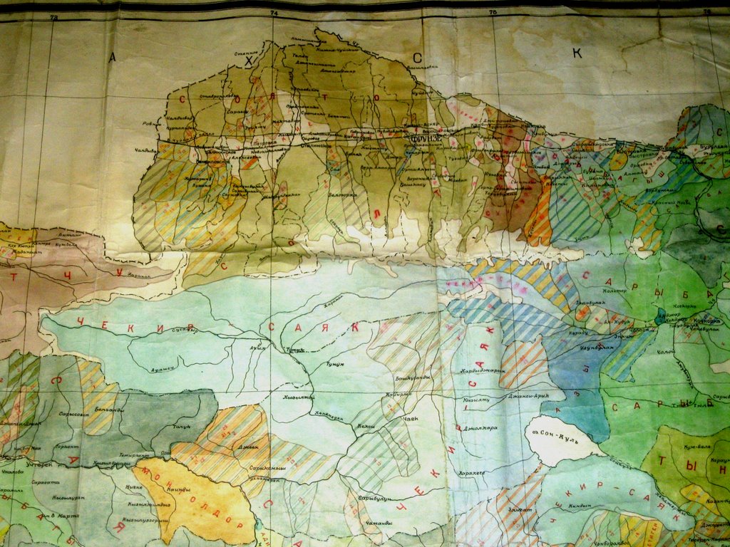 Central Kyrgyzstan (Naryn)
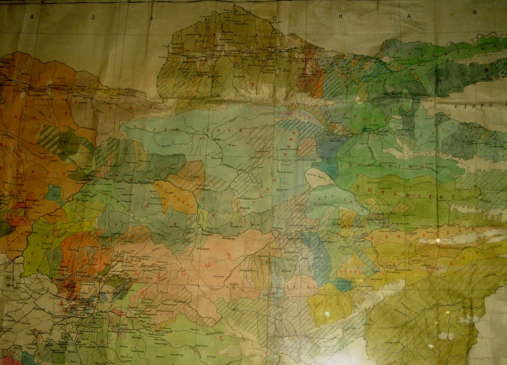 Issykkol
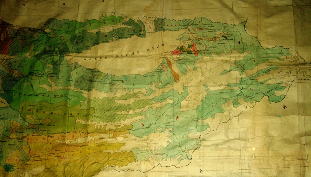 Osh and Jalabad (Center)
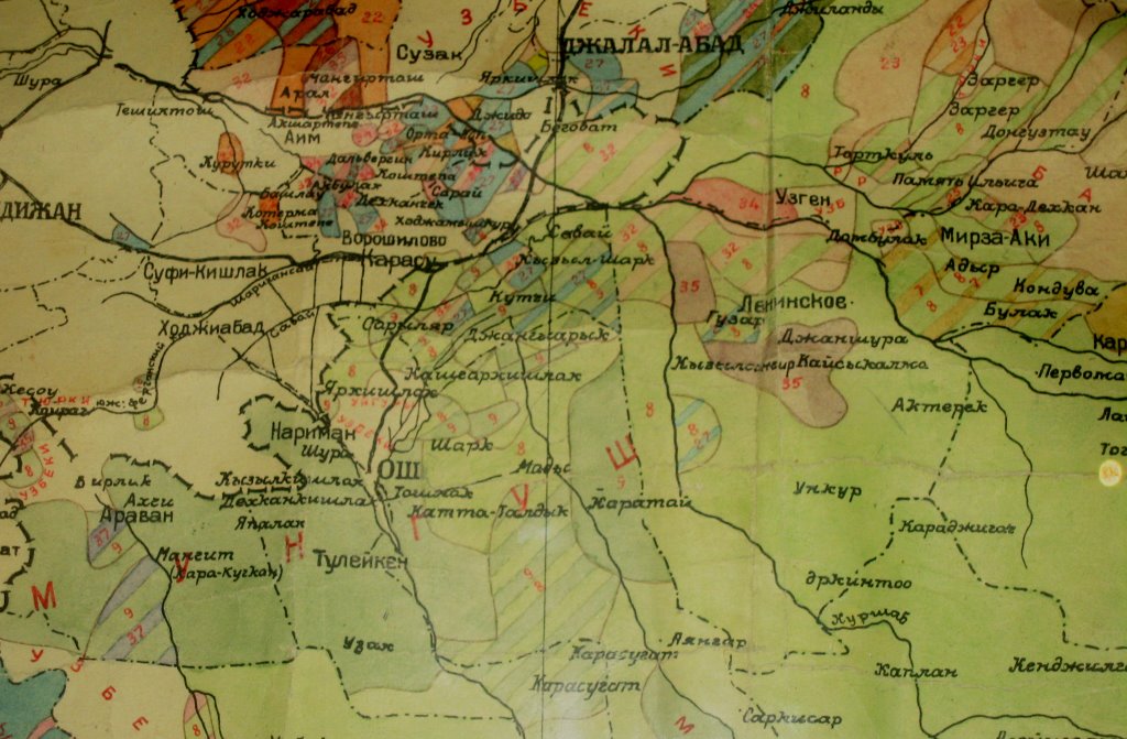 Osh and Batken
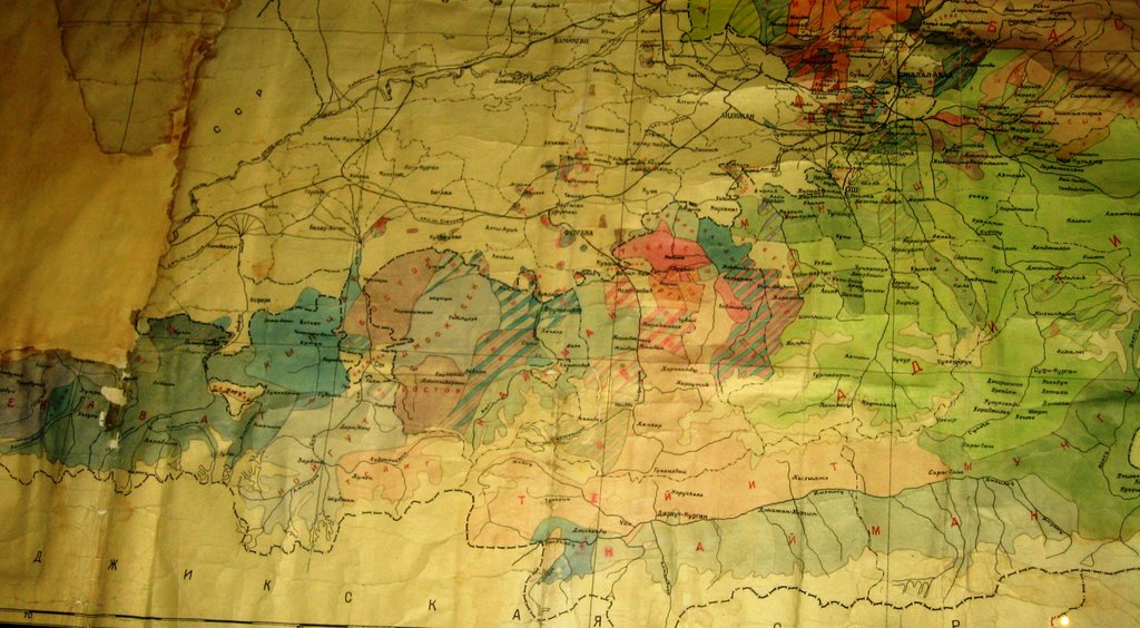


1 comment:
Great blog, Azamat! The ethnic map is not pre-1917. It was done in the 1950s: see the Trudy Kirgizskoi arkheologo-etnograficheskoi ekspeditsii.
Post a Comment